


This week, we have an image supplied by “A”. We nailed last week’s submission; Jeff was at the Three Sixty bar at the Hilton, St. Louis, Missouri.
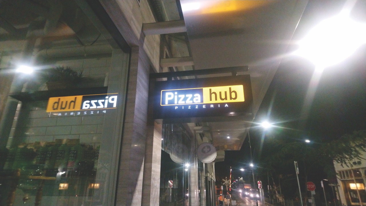 First thoughts: Looks like Aotearoa to me. I can see a railway crossing in the back, too. So it’s probably a decently-sized town or city.
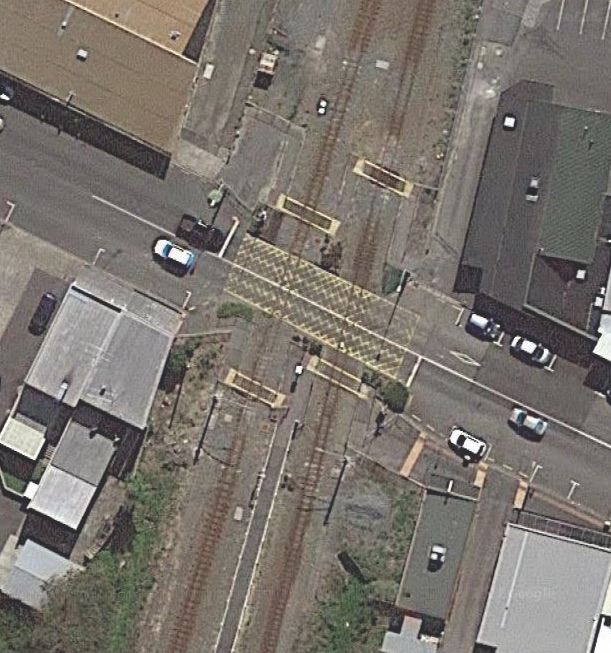
I’m gonna just go straight to google maps and look at all the railway crossings in major NZ cities, starting with the North Island. I don’t want to start with Auckland because it’s so large, but I’m going to do it anyway. I’m looking for a pharmacy to pop up and, of course, Pizzahub. Fortunately for me, it looks like this railway is orthogonal to the road, so I only have to look at right angle crossings, and only those without an overpass. Time to use the satellite map.
Didn’t see a crossing with these requirements on the red, blue, green or yellow lines in Auckland. The fact that someone was out at night when they took this photo also makes me think it might be somewhere more centrally-located, but I’m sure there’s at least a dozen people out there who know exactly where this is from memory. Time to head to Wellington, specifically Upper and Lower Hutt.
Nothing en route to Masterton, but these small towns have me thinking that this might be more rural than I imagined. In the cities, the line is usually passed over by bridges, and the only consistent places to find crossings like this have been small towns. The street patterns in Porirua match this image pretty nicely, and I feel like I’m getting close. I won’t call it yet, though, because I’m known for having trouble with premature exuberation. And… nothing. Nothing by any city or town in NZ with a rail line this small that moves through a small town. That means the worst has been realised: this is international. Fuck.
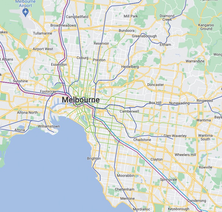
I guess our next best bet is Aus. Streets, etc look the same, so we’re going with Aus. I’m gonna start with Melbourne. Oh my God, it’s so much bigger than New Zealand. This is going to take forever. I’ve traced the pink and light blue lines from southeast to the centre city, and it genuinely took an hour. I’m going to the whole city’s transit lines for crossings and then call it quits. This one is too hard, and it might not even be in Aus.
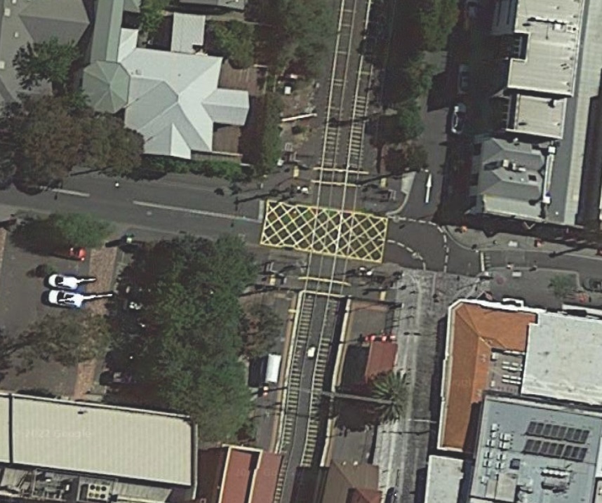
Well, by the grace of God, I think we’ve got it. This’ll take a bit of explaining. After finishing all the major lines, I decided to do one more line, the blue line, headed south from where it meets the light blue and pink. I was looking only for intersections with that distinctive crosshatch pattern, and found one. When I went to street view, I saw no sign of Pizzahub, but I did notice that everything else lined up perfectly. I guess they’ve closed, which means even if I’d wanted to google it, it wouldn’t have worked.
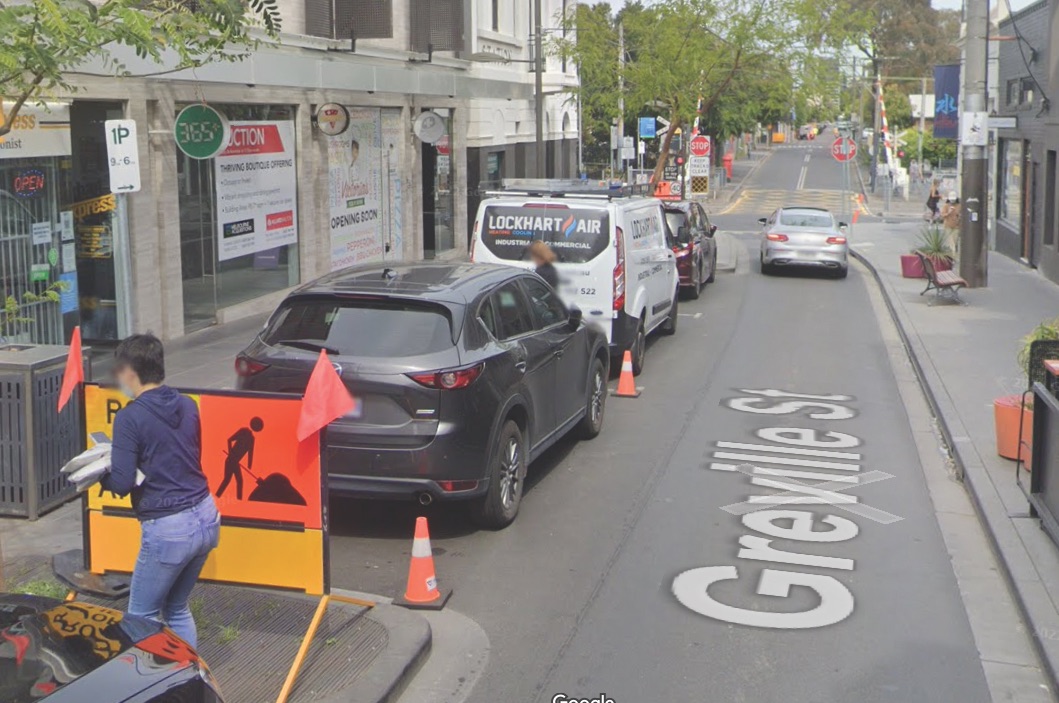 Final answer: Standing outside the business formerly known as Pizzahub, on Greville Street in Prahran, Melbourne. This genuinely took about five hours, and if it weren’t for the extraordinarily lucky decision to start in Melbourne, I would’ve conceded.
Want to send in your own picture? Send an email to maps@critic.co.nz and we’ll give it a shot. Correct answers will be published next week.